The interdisciplinary nature of geospatial data allow an effective utilization of them in many research filed. A cross-fertilization of different research domains is of uttermost importance mainly when dealing with landscape aspects and geospatial science plays a key role in this. For this reason during the course, invited lectures are organized to showcase students this fruitful interaction. In particular, experts coming from external organizations (university, research centers, etc.) are invited to present researches and projects outcomes.
Academic Year 2018-19
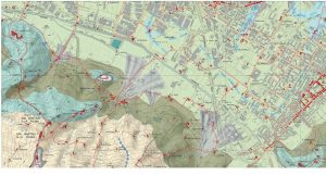
- “The eye of the beholder maps and the shaping of a perception of the world through images”
Iacopo Zetti
Iacopo Zetti, professor at the Department of Architecture, Università degli Studi di Firenze, argues how maps shape the perception of the world through images.
The different aims of mapping activities, one directed to describe places and one directed to measure spaces, are presented showing dozens of examples taken from the history of cartography and from recent researches carried out by himself and his research group “Lapei” starting from the idea that map is a strongly intentional metaphor. Within this general context, the role of cartography as an essential tool for planners, able to show the characters of the landscape, is discussed.
Download: Iacopo Zetti
- “Data management within Spatial Data Infrastructures”
Paolo Tagliolato
Paolo Tagliolato, researcher at the CNR Institute for Electromagnetic Sensing of the Environment IREA, is a computer scientist, expert in the development of Spatial Data Infrastructures. The lecture discusses the relevance of standards involved in current and the international initiatives aimed at defining standard for spatial data sharing (Inspire). The Get-It platform, developed by a joint research group of CNR IREA – ISMAR, based on open source software, is also presented.
Download: Tagliolato
- “Virtual Hubs: a brokered architecture for facilitating open data sharing and use”
Roberto Roncella
Geospatial word is very fragmented and heterogeneous. Geospatial Open Data (GEO OD) are not easily usable by developers who are not expert in geospatial science and technologies. The availability of a “Virtual Hub” mediation components can simplify interaction with geospatial data to non-expert users. The research project ENERGOIC_OD developed a Pan-European Virtual Hub that can be effectively used to efficiently increase usability of Open Data.
Download: Roncella